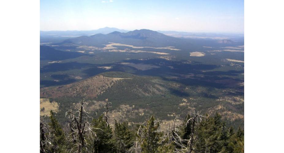
Shady pines, rolling terrain, and dry, breezy air would make Kaibab National Forest an ideal place to run trails all on their own, but the bonus of Grand Canyon views makes this an absolutely unbeatable destination. Imagine cruising along on a perfect day with a constant eyeful of Grand Canyon grandeur spilling away in front of you. That is the reason to run in Kaibab National Forest.
The Grand Canyon is tucked within the national forest, which means that it’s bordered on both sides by free-access public trails. In order to keep these trails available for public recreation the proposal to designate much of the Kaibab National Forest and surrounding public lands as the Greater Grand Canyon Heritage National Monument is underway.
While not every path here hugs the canyon rim, there are more than 300 miles of trails to explore, countless jewels of scenery, and quality hidden among the pines.
For the best of the best, here's a rundown of 6 awesome trails to run in the proposed monument.
1. Rainbow Rim Trail
Mileage: 17.5-miles one way
Difficulty: Moderate
 A view from the Rainbow Rim Trail into the Grand Canyon. USFS, Southwestern Region, Kaibab National Forest
This is the premier route on the North Rim —perhaps even better than any rim trail within the national park itself. Because it is entirely within the national forest, it is free to access and open to runners, mountain bikers, horseback riders, and backpackers. It connects 5 prominent overlooks in 17.5 miles of top-notch singletrack, with unbelievable views the entire time. The trail is very remote and entirely above 7,500 feet elevation, so running the whole thing is a pretty serious undertaking. Forest service roads access the trail at multiple points and are mostly passable for 2-wheel drive cars in dry weather.
2. Lookout Canyon
Mileage: Variable
Difficulty: Moderate
 Southwestern Region, Kaibab National Forest. U.S. Forest Service
There are several trails named Lookout Canyon, but with different numbers (Trails 120, 121, and 122), which can be tricky to navigate on a map. But it’s worth the effort to explore them, as all three trails wind through some of the most remote, yet beautiful, terrain in Arizona — in other words, paradise for a trail runner craving some solitude.
The trails are located on the Kaibab Plateau, and the trailhead can be found on a dirt road, Forest Road 22, some 15 miles from the closest paved one. Start off heading north on Trail 121 (Trail 122 parallels it to the east), which eventually culminates in the canyon and intersects with Trail 120. Trail 121 is a gradual descent on the way into the canyon, cruising through an easily navigable route rich with aspens and ponderosas, but keep in mind that you’ll be able to feel that grade on the way back. The trailhead is located off FR 6033.
3. Tusayan Bike Trails
Mileage: Variable
Difficulty: Easy-moderate
 Tusayan Trail. Ken Lund
The network of trails around Tusayan have been popularized by mountain bikers looking for casual afternoon rides, but they are just as good for trail runs as well. There are four different trails with connected loops, allowing for variable mileage and difficulty. The terrain is gently rolling double-track through open ponderosa forest that is pleasant almost any time of year. The best starting point is from FR 605 off Highway 64.
4. Gooseneck Trail
Mileage: 10-miles round trip
Difficulty: Moderate-Strenuous
This is a rugged trail in a remote wilderness area on Grand Canyon’s North Rim. Sparse travel makes it a more adventurous run than others on this list, but the scenery is unbeatable. It is named for the prominent peninsula of land which the route traverses, and offers unrivaled views of Kanab Creek Canyon from a 2,000 foot-high vantage. The trailhead is on FR 227, which may be difficult for low-clearance vehicles.
5. Arizona Trail, Coconino Rim Section Tusayan
Mileage: Variable
Difficulty: Easy-Moderate
 Grandview Lookout Tower. Zruda
The Arizona Trail bisects the state from north to south, covering roughly 800-miles and linking some of the most incredible scenery from canyons to mountains to deserts. The Tusayan district of Kaibab National Forest includes 24 miles, which has multiple access points and various options for mileage. The best place to start a run is at the Grandview Lookout Tower on FR 302. This trailhead is shared by the easy 1-mile loop Vishnu Trail, which grants views into the Grand Canyon from a highpoint in the forest.
6. Jumpup Canyon
Mileage: 6-miles one way
Difficulty: Moderate to Difficult
 Arizona Jumpup Trail. U.S. Forest Service
This rugged trail in the Kanab Creek Wilderness is a serious quad-tester, dropping some 2,000 feet initially (and don’t forget that you’ll have to reclimb that on the way back). But the gorgeous scenery — panoramic views of steep sandstone canyons, natural rock sculptures, pockets of pinon and juniper — offers some nice distraction. Before reaching Jumpup Canyon, the trail also winds its way through Sowats Canyon. The Ranger Trail to Kanab Creek joins the trail at this point, so runners can continue up Jumpup Canyon until it meets FR 423. But keep in mind that this trail is located in a very remote area with limited water, so bring plenty of your own, and temperatures soar in the summer. Bottom line: It’s not the best bet for newbies.
Of note: The proposed Greater Grand Canyon Heritage National Monument encompasses the public lands surrounding the Grand Canyon, and would ensure that development is kept in check and that the running trails here stay accessible forever. Learn more about the proposal for making the lands around the Grand Canyon a national monument and get involved.


