An Insider’s Guide to an Unforgettable Weekend in Rocky Mountain National Park
Consider yourself lucky if you happen to have 48 - 72 hours to spend in the friendly confines of Rocky Mountain National Park. Weekend adventures in Colorado’s most popular wilderness area require planning in advance, especially if you’re aiming to set up camp at one of the car-camping/RV-friendly campgrounds. Backcountry campers can plan their trips out a little more spontaneously and, of course, there’s always the option to have day adventures in the park then retreat to lodging in Estes Park, Grand Lake, or Lake Grandby. It all depends what you want to see and experience.
For RV/car camping reservations and information, visit the NPS RMNP site. For backcountry camping options, read more for reservations and information. And for information on staying in Estes Park, check out the Estes Park tourism page for lodging.


Views right off Trail Ridge Road looking at Hayden Spire (left) and Mount Ida (right). - James Dziezynski
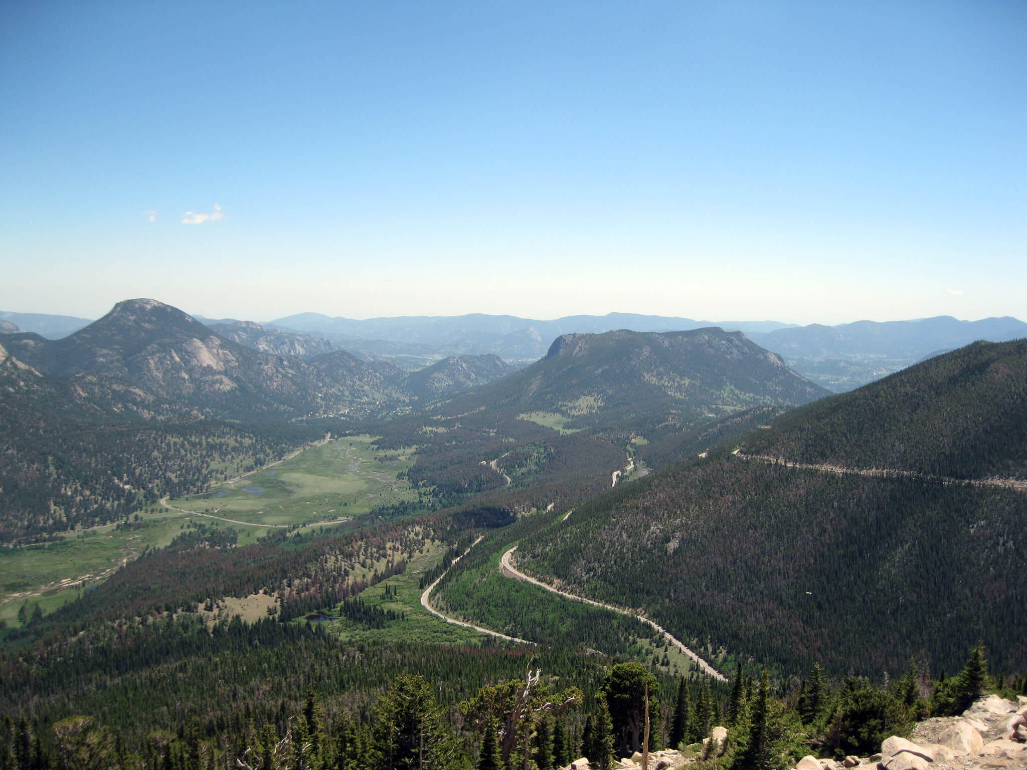
Many people come to the park simply to enjoy the mountainous views. This is best done by touring along Trail Ridge Road, the 48-mile, paved road that runs through the park. Even though it tops out at an exposed 12,183 feet it’s not the highest paved road in America (or even in Colorado, the honor for both is claimed by 14,130-foot Mount Evans Road). Nonetheless, there is plenty to see.
A full day can be made of driving from the Beaver Meadows entrance station on the east (Estes Park) side of the park all the way up and over the highest point, down to the Colorado River and then back. Weekend traffic often crawls along the upper reaches of the road, partially due to the expansive views of the park’s highest mountains, and in part due to the unnerving exposure the road presents for some drivers. Never fear, the road is always wider and safer than it may appear!
There are dozens of scenic pull offs along the way and the Alpine Visitor Center near the top of the road offers an opportunity to get out in the open air and hike around on several short trails. A tour of the road is a classic and memorable experience, especially for families, photographers, or those who have never had a chance to soak in the beauty of Colorado’s Rocky Mountains.


Trail Ridge Road is the most popular way to see the park. - James Dziezynski
For many, however, simply seeing the park isn’t enough. They want to immerse themselves in it. There are hundreds of day hiking options, from casual strolls to epic peak bagging. On the less strenuous side, hikes to lakes and waterfalls are popular adventures. One of the best areas to do this is from Bear Lake trailhead, a bustling but beautiful trailhead that quickly fills up with parking requiring a (free) shuttle ride.
Bear Lake is literally right at the trailhead, but many other scenic alpine lakes are nearby. Less than 3-mile (one-way) hikes include: Nymph Lake, Cub Lake, Mills Lake, Dream Lake, Fern Lake, and Bierstadt Lake. For a longer day hike from this trailhead, the 10-mile round trip to Sky Pond is a worthy trek.
Glacier Gorge trailhead is on the same road as Bear Lake trailhead (all Glacier Gorge destinations are reachable from the Bear Lake trailhead). One of the best hikes from here is Jewel Lake/Mills Lake, a 6.2-mile round trip outing. The cirque of peaks from Jewel Lake is impressive, towering over the valley floor, often with plumes of snow whipping from the exposed ridges.
If waterfalls are on your agenda, Wild Basin is the place to be. On a 7- or 8- mile round-trip adventure, hikers can visit Copeland Falls, Calypso Cascades, and the modest-but-mighty Ouzel Falls. Even though the mileage may seem high, the trail to these waterfalls has low-grade elevation gains and is never too strenuous. More ambitious hikers can continue beyond Ouzel Falls (the last in the trio) to Lion Lakes or the deep basin at Thunder Lake—either destination can be hiked in and out in a full day, around 10-12 miles.
RMNP has 120 backcountry campsites. These require a backcountry permit, a $26 fee, and some planning for reservations, but it is by far the most intimate way to see the park. For more information on these campsites, visit the extensive NPS backcountry site. As a general rule, many of the campsites are near lakes or streams and the western trails tend to be less busy than the eastern destinations—unless you’re considering wildlife traffic!


Along the Chapin to Chiquita trail run. - Sheila Powell
If you want a run that mostly stays above treeline check out the Chapin Creek Trailhead. There’s a prelude to the peaks in sparse treeline for a little over a mile, then the epic alpine plateau that connects Chapin, Chiquita, and Ypsilon Peaks opens up. You’re going to be chugging up over 12,000 feet so it’s difficult to hammer out this seven-mile out and back run, but as your lungs burn you’ll be treated to some of the most iconic views in Colorado.
Finally, as a bit of a bonus there’s always the option to run Trail Ridge Road itself when the road closes, usually from mid-October until April. There may or may not be snow. In winter, this road allows leashed dogs (don’t stray from the road) so it’s a rare opportunity to visit RMNP with your pooch! Run as long you like—the entire road is 48 miles one way, so you likely won’t be doing the whole thing.
